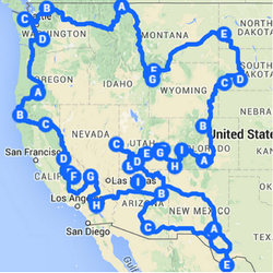
 Our 18,000 mile route to 33 national parks.
 6 months, 33 National Parks, 18000 miles, One Life-Changing Experience, and how you can do it too!
For the first half of our year-long honeymoon, we spent 6 months visiting 33 national parks in 16 western states. Yes, we went to every western national park in the lower 48, which gets us more than half of the way to our long-term goal of seeing all 59. We put more than 18,000 miles on our car, hiked 25 marathons worth of distance on scores of trails, took countless photos, met many fascinating people, and so much more. And we did this for just $9000, including expenses for transportation, camping, food, gear, and everything else.
But how, we get asked again and again, was such a thing possible? Well, we spent the better part of a year planning, agonizing over the best routes and timing, creating a detailed budget, and saving up money. This was a life-changing experience, so I'm here to offer tips on what we learned and hopefully encourage more people to go out on epic National Parks road trips of their own! Probably the most important components of a trip like this are: planning your route, deciding when to go, and figuring out how much it will cost. So, without further ado, here's our review of all the parks we went to. Plus, scroll down for detailed info on how we planned the route, timing and budget.
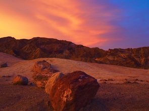 Sunrise from Zabriskie Point in Death Valley.
 Reviewing the Parks
Here are our reviews of all of the national parks we went to, in the order we visited. Hopefully, this accumulation of info will be helpful to you as you plan your own epic parks roadtrip! Click through each link for our full review, recommendations on what to do (and not), plus lots of photos.
1. Pinnacles (CA) - The newest national park, just upgraded from a Monument to a Park in 2013, has some cool hikes and caves, as well as world-class rock climbing.
2. Death Valley (CA) - Perhaps the nation's best collection of oddities, Death Valley is home to the Racetrack, where rocks slowly coast along a flat dry lake bed, Badwater, the lowest point in the U.S., enormous sand dunes, and much more.
3. Joshua Tree (CA) - A surreal landscape that looks like it could come from a Dali painting, Joshua Tree has excellent climbing, hiking, beautiful oases and more, all within a couple hours of Los Angeles.
4. Grand Canyon (AZ) - One of the best known features of the American landscape, the GC needs little introduction. We enjoyed our hike down into the Canyon, but if you want to camp, be sure to get reservations and/or backpacking permits well in advance.
5. Petrified Forest (AZ) - A drive-through park with no camping and short trails, this little guy doesn't take long, but its forests of fallen petrified trees are among the best preserved and largest in the world.
6. Saguaro (AZ) - Split into two sections on either side of Tucson, AZ, Saguaro boasts a lovely desert landscape.
7. Guadalupe Mountains (TX) - Go to hike up Guadalupe Peak, the highest peak in Texas and a fairly easy day hike, or to do longer backpacks on the park's many trails.
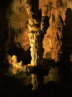 Stalagmite in Carlsbad Caverns.
 8. Carslbad Caverns (NM) - What a strange and different place it is underground in Carlsbad Caverns. The free, self-guided Natural Entrance and Big Room tours are absolutely worth your trip. If you additionally have the time and means, check out the reservable tours as well.
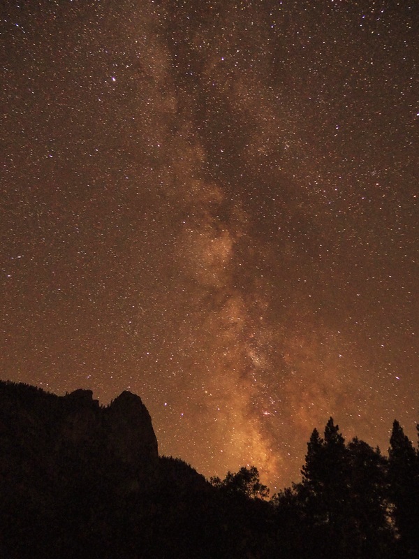
9. Big Bend (TX) - One of the most remote parts of Texas and the nation, Big Bend features incredible dark night skies and great hiking in the Chisos mountains. Just don't worry about spending too much time over in Rio Grande Village, its not worth the extra drive.
10. Zion (UT) - Zion Canyon feels like an incredible escape in itself. Add in the iconic hikes to Angel's Landing, the Narrows, the Subway and more, and you have the superlative Zion National Park.
11. Great Basin (NV) - Occasionally labeled the forgotten national park, Great Basin is actually full of fun things to do, like going for a cave tour, watching a night sky program, or hiking Wheeler Peak.
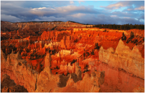 The Amphitheater, Bryce Canyon NP.
 12. Bryce Canyon (UT) - Bryce Canyon's landscape feels surreal when viewed from above, but take a hike down among the hoodoos and red-rock slopes and you're in another world.
13. Capitol Reef (UT) - We were both nicely surprised by Capitol Reef. It's not Utah's best known park, but its got a lot going for it from plentiful pick-your-own fruit orchards to lots of nice trails to gorgeous sunsets.
14. Canyonlands (UT) - Much like it's Utah brethren, Canyonlands is a desert-canyon-rock dreamscape you have to see to believe. Camping is tricky here so be sure to plan ahead, but staying on the Island In The Sky is worth it, so we recommend making the effort.
 Navajo Arch in the afternoon sun, Arches NP.
 15. Arches (UT) - Arches is a gem of the park system. Wandering here and happening across any of the park's 2000+ natural arches feels like finding a prize. Don't miss the Devil's Garden hike, including the Primitive Trail - it was one of our absolute favorites. The popular hike to Delicate Arch is also great, often described as one of the best designed trails in the entire park system.
16. Mesa Verde (NM) - No other parks on this list boast archaeology of such cultural significance as Mesa Verde. With so many sites to choose from, it can be hard to decide what to do in Mesa Verde. We really enjoyed the Balcony House Tour, but Park Rangers can help you choose something that works for you.
17. Black Canyon of the Gunnison (CO) - It's fascinating to see thousands of years of the forces of nature at work on the walls of the Black Canyon, especially the Painted Wall. This is mostly a driving park, between many lookouts, unless you are up to a strenuous hike down to the bottom of the canyon (we weren't, but don't let that stop you).
18. Great Sand Dunes (CO) - Where else can you hike to alpine peaks and lakes, play in giant sand dunes, and float on a river's waves all in the same day? GSD has a lot to offer, especially for a park many people have never even heard of.
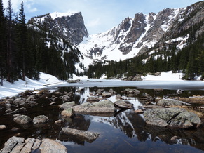 Dream Lake, Rocky Mountain NP.
 19. Rocky Mountain (CO) - The only downside to RMNP is its close proximity to metro areas of Boulder and Denver, meaning its often quite crowded. But the upsides are worth it: picturesque alpine lakes and mountains, lots of wildlife, and exceptional hiking, to name a few.
20. Wind Cave (SD) - Having been so recently to Carlsbad Caverns, we were pretty sure Wind Cave wouldn't match up, not least because WC charges you to take their tours while CC's main tours are free. So, yeah, we didn't go into the cave and don't have much to say here.
21. Badlands (SD) - South Dakota's other park, however was a delightful time with its strange rock formations, plentiful mountains goats and bison, and the remote, but beautiful (and free) Sage Creek Campground.
22. Theodore Roosevelt (ND) - If you like horses, this is the place for you. Lots of trails designed for equestrians and lots of wild horses are what we found.
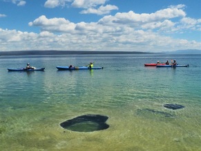 Kayakers, Lakeshore Geyser, Yellowstone.
 23. Yellowstone (WY) - An expansive area the size of Delaware and Rhode Island combined, Yellowstone has vast stretches of backcountry, teeming wildlife, enormous lakes, and rivers, and oh, a Super Volcano. It's hydrothermal features (geysers, hotsprings, etc.) would be enough to earn its keep, but add the rest and Yellowstone is something truly special. We were there for four weeks, so we wrote a lot about it. In addition to the link above, check out more on the Tower/Canyon area, Mammoth Hot Springs, and that time we stayed up all night to watch geyers going off under the stars, aka our all night geyser party.
24. Grand Teton (WY) - Just to the south of Yellowstone lies Grand Teton NP. With hikes like Cascade Canyon and Holly Lake, GT is a real treat. Also, we really enjoyed spending time lounging on the shore of Jackson Lake and using the wireless in Jackson Lodge's beautiful main room.
24. Grand Teton (WY) - Just to the south of Yellowstone lies Grand Teton NP. With hikes like Cascade Canyon and Holly Lake, GT is a real treat. Also, we really enjoyed spending time lounging on the shore of Jackson Lake and using the wireless in Jackson Lodge's beautiful main room.
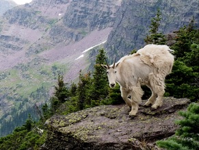 Mountain goat on Gunsight Pass, Glacier NP.
 25. Glacier (MT) - Glacier was one of our top two favorites. Take its category-best hiking. Or its accumulation of wildlife. Or its glaciers. Any one of these would be enough reason to visit Glacier. But it has all of them and more. If you can only visit one park next year, this should be it! And if you haven't been there already, you should visit soon, as the predictions suggest Glacier National Park will have no glaciers remaining by 2020.
26. North Cascades (WA) - Northeast of Seattle, right up against the Canadaian border, lies North Cascades NP, an unsual park complex consisting of a national recreation area and two units of the national park. We didn't find much to see in the recreation area, but the national park was lovely, especially Cascade Pass.
26. North Cascades (WA) - Northeast of Seattle, right up against the Canadaian border, lies North Cascades NP, an unsual park complex consisting of a national recreation area and two units of the national park. We didn't find much to see in the recreation area, but the national park was lovely, especially Cascade Pass.
 Sunset, Shi Shi Beach, Olympic NP.
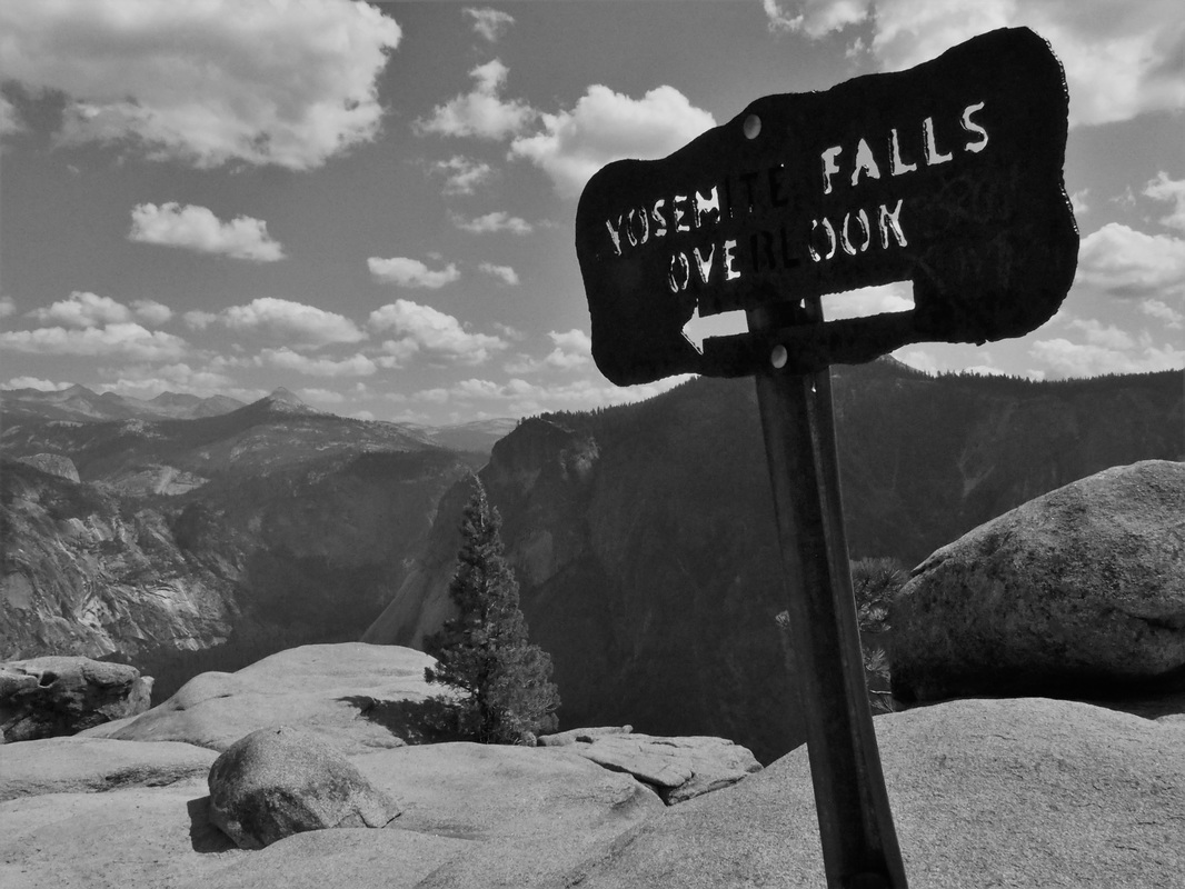
 27. Olympic (WA) - If Glacier was one of our top two favorites, Olympic was the other. There is such an incredible variety of activities and awe-inspiring scenery. You can go to Olympic to explore its beautifully rugged coastline. Or long-distance trek to the glacier-capped peak of Mt. Olympus. Or delve into the temperate rain forests of the Hoh and Quinault Valleys. Backpacking to Shi Shi beach for sunset was one of our trip's top highlights.
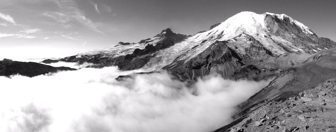
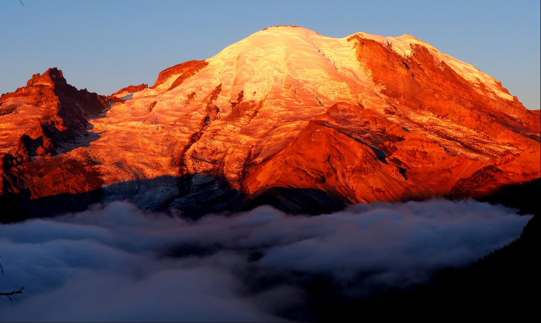
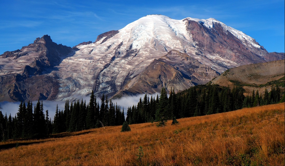
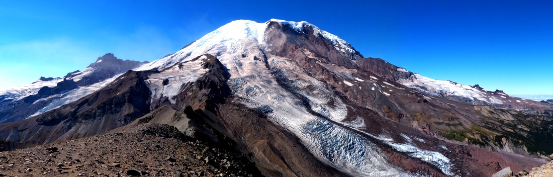
28. Mt. Rainier (WA) - Washington hits another homer with Mt. Rainier NP. Watching the sun rise on the mountain's eastern slope is almost spiritual, and the same came be said of the sunset from the western slope. Meanwhile, the hiking is stupendous on either side, with trails in the Paradise area and the Burroughs trail taking the proverbial cakes. If you're there in late summer, you get the added bonus of enjoying wild blueberries and huckleberries.
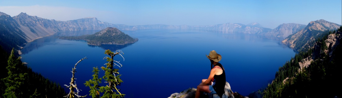
29. Crater Lake (OR) - Crater Lake is undeniably beautiful. Take a short hike (there are several options) along the rim and you'll see the bluest blue you can imagine. There's not much other hiking in Crater, unless you want to fork out the cash for a boat ride around the lake, and then you can hike on Wizard Island. You can also drive around the lake to a variety of lookouts.
28. Mt. Rainier (WA) - Washington hits another homer with Mt. Rainier NP. Watching the sun rise on the mountain's eastern slope is almost spiritual, and the same came be said of the sunset from the western slope. Meanwhile, the hiking is stupendous on either side, with trails in the Paradise area and the Burroughs trail taking the proverbial cakes. If you're there in late summer, you get the added bonus of enjoying wild blueberries and huckleberries.
29. Crater Lake (OR) - Crater Lake is undeniably beautiful. Take a short hike (there are several options) along the rim and you'll see the bluest blue you can imagine. There's not much other hiking in Crater, unless you want to fork out the cash for a boat ride around the lake, and then you can hike on Wizard Island. You can also drive around the lake to a variety of lookouts.
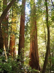 Redwoods, in Redwoods NP.
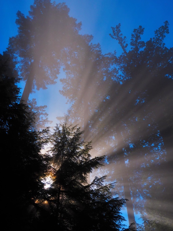
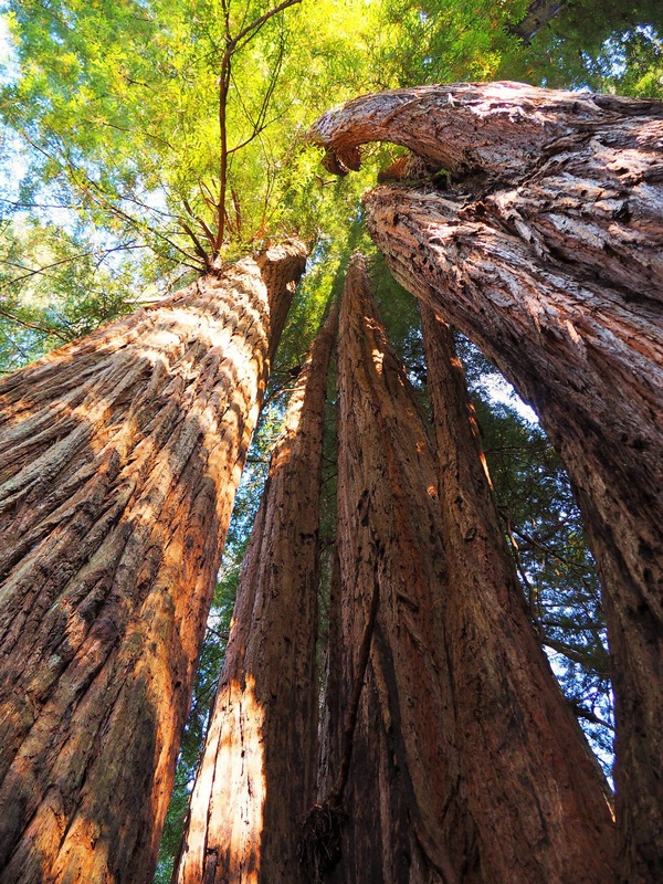
 30. Redwoods (CA) - Hang out with the world's tallest trees in Redwoods NP. The coastal redwoods here can soar to over 370 feet. This is especially true in Tall Trees Grove, within which grows Hyperion, the world's single tallest tree (though its exact location is undisclosed). You need a free permit to visit Tall Trees Grove, and its absolutely worth the small bit of time it takes to go to the visitor center to get one.
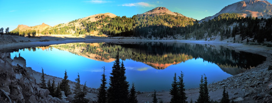
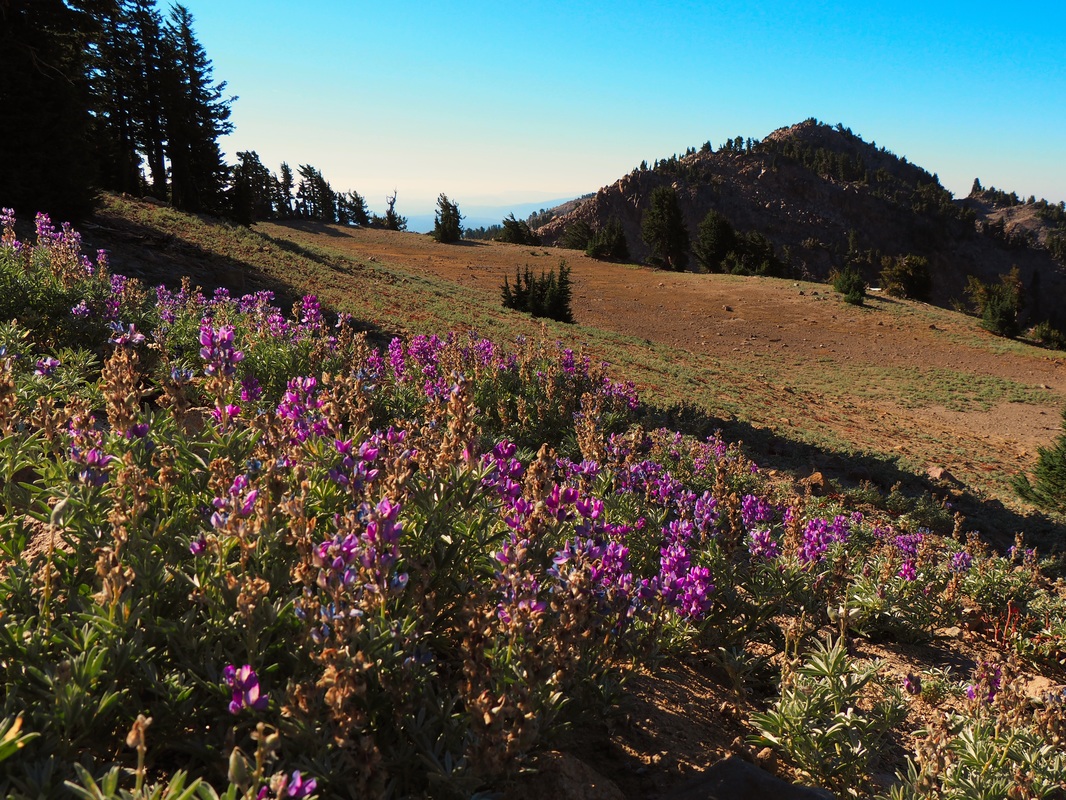
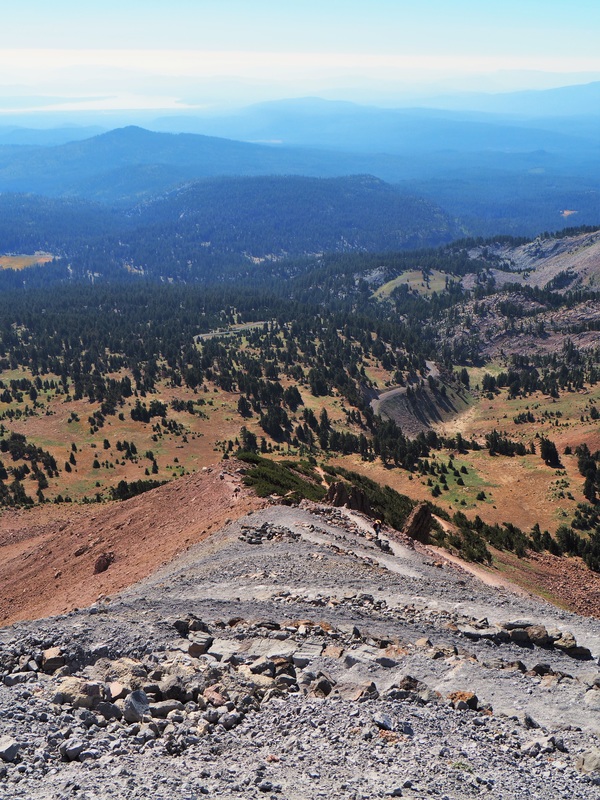
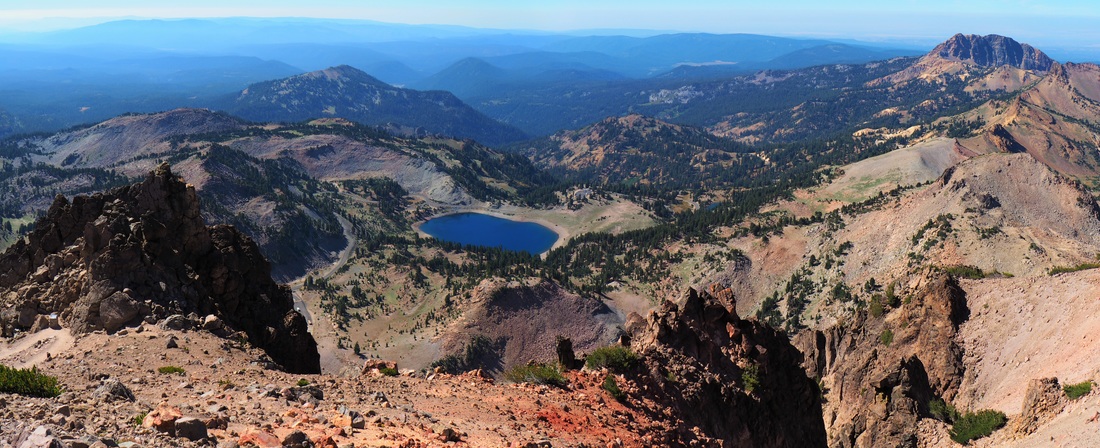
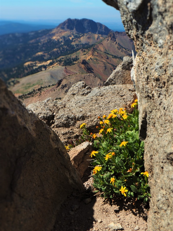
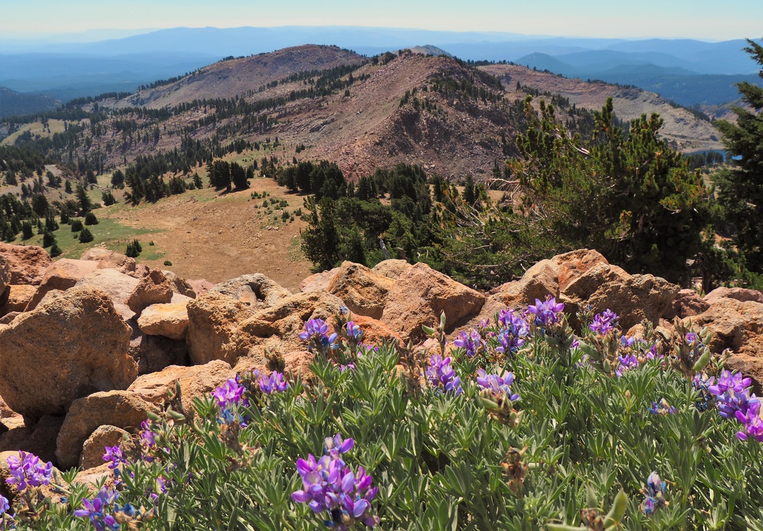
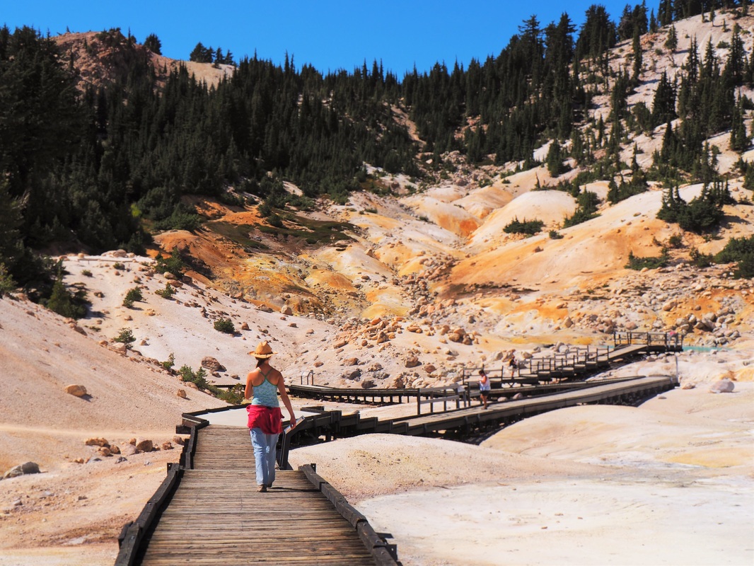
31. Lassen Volcanic (CA) - Lassen Volcanic feels a bit like a tiny Yellowstone, with its hydrothermal features at Bumpass Hell. But its also got some nice hiking, especially the day hike up Lassen Peak.
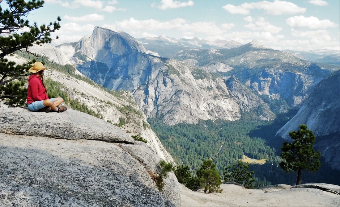
32. Yosemite (CA) - Yosemite is the High Sierras at their best. The hike up Half Dome is one of the best hikes in the world. But you've also got El Capitan here, a well-maintained and expansive backcountry, abundant waterfalls, and so much more. And all of this only a few hours from San Francisco. Yosemite should be a centerpiece to any parks road trip.
31. Lassen Volcanic (CA) - Lassen Volcanic feels a bit like a tiny Yellowstone, with its hydrothermal features at Bumpass Hell. But its also got some nice hiking, especially the day hike up Lassen Peak.
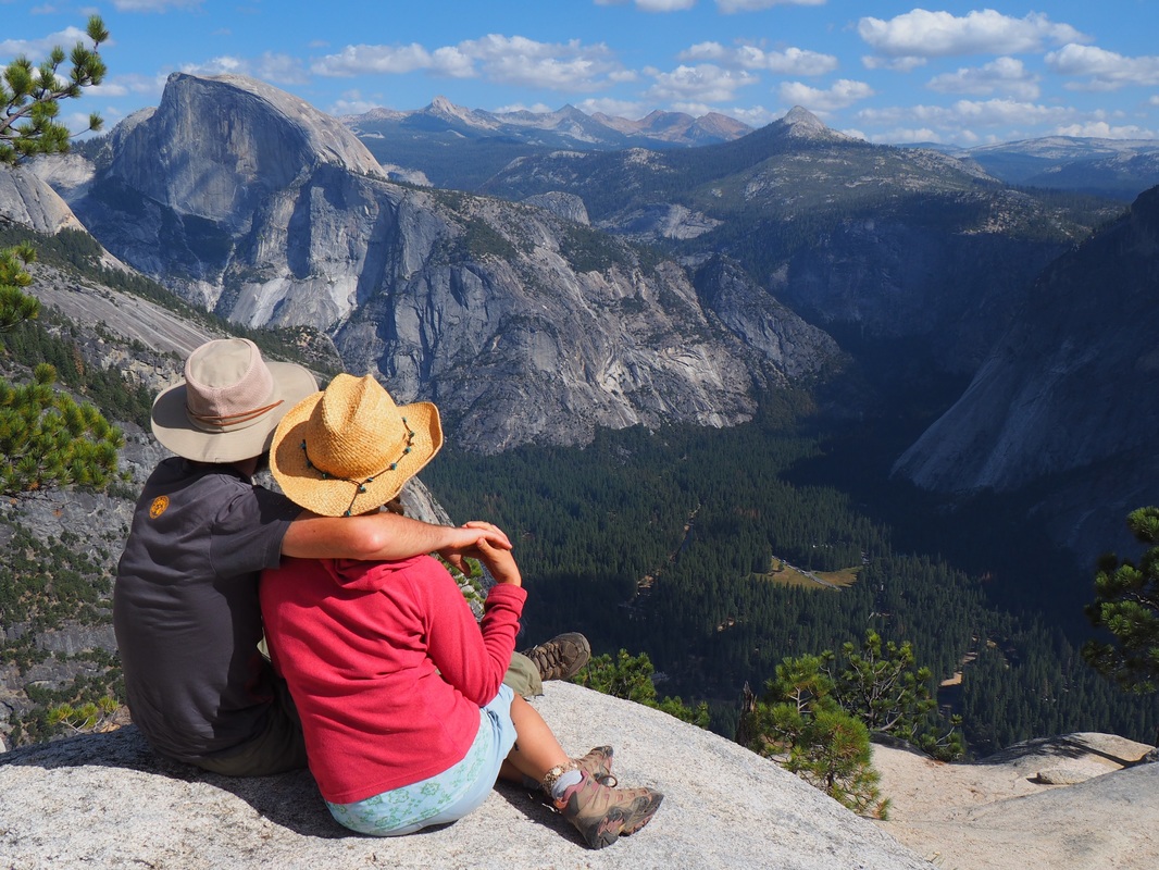
32. Yosemite (CA) - Yosemite is the High Sierras at their best. The hike up Half Dome is one of the best hikes in the world. But you've also got El Capitan here, a well-maintained and expansive backcountry, abundant waterfalls, and so much more. And all of this only a few hours from San Francisco. Yosemite should be a centerpiece to any parks road trip.
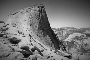 Half Dome, Yosemite NP.
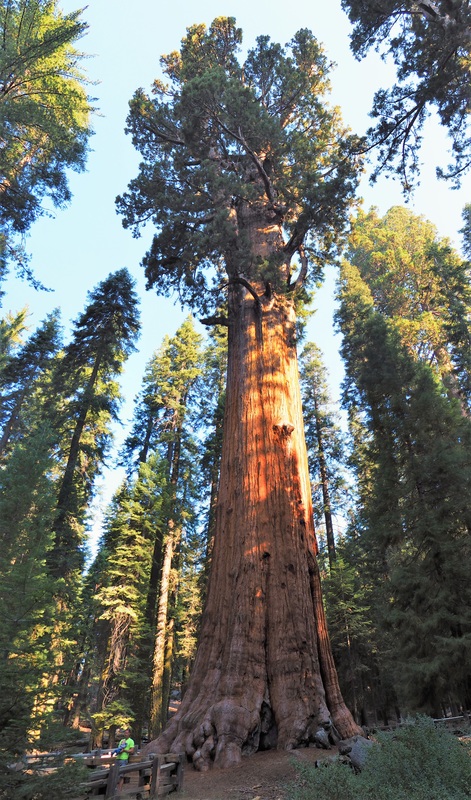
 33. Sequoia (CA) - We had to cut our trip to Sequoia and Kings Canyon NPs short due to a massive wildfire in the area, but hopefully you won't have the same problem. Both parks have groves of Giant Sequoias, the world's largest trees by volume. Kings has the Rae Lakes backpacking loop, one of the best backpacks available. And from these parks you can access Mt. Whitney, the tallest peak in the lower 48.
34. and 35. Between Olympic and Mt. Rainier, we actually flew to Hawaii to see the islands' two national parks, Haleakala and Hawaii Volcanoes, but those aren't discussed here in depth because, well, they're not exactly road-trip accessible.
34. and 35. Between Olympic and Mt. Rainier, we actually flew to Hawaii to see the islands' two national parks, Haleakala and Hawaii Volcanoes, but those aren't discussed here in depth because, well, they're not exactly road-trip accessible.
Planning Your Trip
| Which Parks to Visit and for How Long? The first thing you need to do is figure out how much time you have for your trip. With that, you can decide how many parks to visit and how much time to spend at each. With unlimited time, you could visit all 59 parks and get to know each one of them incredibly well. But most people, including us, don't have unlimited time. We wanted to see as many parks as possible, while also getting the most bang for our buck. This meant, in short, limiting ourselves to the more closely packed parks of the West. On our trip, we determined our route so that the drives between parks could all be done in a reasonable day, and we only had one drive of more than 10 hours. We took six months to see these 33 parks, described in detail below. At a chaotic rush, you could probably see them all in 3 months, but if you want to do the same route as we did, I'd recommend a minimum of 4 months to see them well and do the parks justice. Any less and there's a good chance you'll have trouble experiencing the parks in full and also run into seasonal issues described at right. | When to Go? Deciding when to go, of course, depends on which parks you want to visit. The parks in the northern mountains are partially closed down in the late fall through early summer. Similarly, the Southwest can be dangerously hot in the summer. In other words, if you only want to visit northern mountainous parks like Glacier, you should consider starting no earlier than June because the parks' main attractions aren't generally open earlier. Our basic plan was to be in the Southwest in springtime, in the northern mountains in the early summer, and in the Northwest in the late summer. This worked out pretty well for the most part, though we got rained and snowed during an unusually wet and cold May for Colorado. Otherwise, the weather was largely agreeable and we rarely found trails still closed for the season or unopened sections of parks. 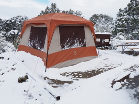 Our tent after a snow storm in Great Sand Dunes in May. |
How much does this cost?
If you're like us, and you're road-tripping on a shoestring budget, you're looking to save money however possible. The good news is that long-term camping in the parks is pretty affordable. We ended up spending about $1500 per month all inclusive, which is less than we spent on rent/utilities alone in our old DC apartment. By far, our major expenses were food, campsite fees, and gas, in that order. We also spent money on activities, car insurance and maintenance (we needed four oil changes in those six months!), gear, and other random things.
You can determine a basic gas budget if you know your car's average gas mileage, the average price of gas, and how far you plan on driving. To get this latter figure, find the total distance between the parks you want to see (Google Maps is helpful for this), and then basically double that mileage to get a decent estimate of the total you'll drive in and around the parks.
For campsite fees, we budgeted on an average of $12 per night for campground reservations. In retrospect, this was probably a little low. $15 per night is a better bet. And we predominantly stayed in the cheaper campgrounds that NPS itself runs... the concessioner run campgrounds are more expensive, more crowded, and generally not as social, though they tend to have more services like showers and laundry. NPS also has detailed information on costs of every campground on its website.
OK, those are all the basics of where we went and how we planned out 6-month, 18,000-mile road trip. We hope this info will be helpful to you!
And definitely feel free to ask any questions you have in the comments.
All photos copyrighted by the Author.


 RSS Feed
